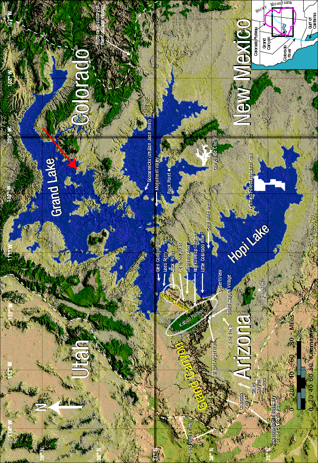
Figure 119: Geographic Features. Major geographic features described in this chapter are shown above. Two former lakes, Grand Lake and Hopi Lake, are superimposed on today’s terrain, shown in nearly true color. The white oval encloses the high Kaibab Plateau, which extends slightly south of the Colorado River. The circle marks the north half of Marble Canyon, about a dozen barbed canyons, the funnel, and parts of Echo Cliffs and Vermilion Cliffs. All are discussed later. The dashed white line marks the boundary of the uplifted, roughly circular Colorado Plateau, also shown in the inset.
Grand Lake held a volume of water almost twice that of Lake Michigan. The volume of water in Hopi Lake was roughly that in Lake Huron.1 To appreciate the size of Grand Lake, see Figure 140 on page 235. That photograph was taken in the direction of and from the tip of the red arrow above.